Myanmar
Beginning in the 9th c., the early Pyu and Mon constitute some of Myanmar's earliest recorded civilizations. The region was consolidated under the Bagan in the 11th c., and in part due to its close links with India, Theravada Buddhism began to take root in the country. Though Theravada Buddhism is the predominant religion today, Mahayana and Tantric Buddhism as well as Hinduism were commonly encountered. As Myanmar fought to rebuff Portuguese and Chinese advances, they eventually became absorbed into British India in 1824. In WWII Myanmar was occupied by Japanese forces who fought the British and local forces. In 1948, Myanmar was an independent state until a 1962 coup-d'etat installed military-led leadership, which lasted until 2011.
Feature Type
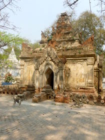
A small temple in Maing Tauk.


- Myanmar (Unknown, Latin script, Original)
- > འབར་མ (Unknown, Tibetan script, Transcription-English-to-Tibetan Transcription)
- > 'bar ma (Unknown, Latin script, Transliteration-THL Extended Wylie Transliteration)
- > འབར་མ (Unknown, Tibetan script, Transcription-English-to-Tibetan Transcription)
- 缅甸 (Unknown, Simplified Chinese Characters, Original)
- > འབར་མ (Unknown, Tibetan script, Transcription-Chinese-to-Tibetan Transcription)
- > 'bar ma (Unknown, Latin script, Transliteration-THL Extended Wylie Transliteration)
- > Barma (Unknown, Latin script, Transcription-THL Simplified Tibetan Transcription)
- > Barma (Unknown, Latin script, Transcription-THL Simplified Tibetan Transcription)
- > འབར་མ (Unknown, Tibetan script, Transcription-Chinese-to-Tibetan Transcription)
Place ID: F5242
ISO 3166-1 alpha-2: MM
ISO 3166-1 alpha-3: MMR
ISO 3166-1 numeric: 104
FIPS 10-4: BM