Tibet Autonomous Region
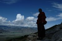
Established in 1965, the Tibet Autonomous Region (TAR) is a contemporary administrative unit of China that includes the cultural regions of Western and Central Tibet, as well as parts of Eastern Tibet, and spans an area of more than 1,200,000 km2. As part of the Tibetan Plateau, the TAR contains several of the world’s highest mountains (Mount Everest), lakes (Yamdrok Yumtso), and rivers (Yarlung Tsangpo). With its capital of Lhasa the region supports a population of over 3 million.
Feature Types
(Untitled)
- བོད་རང་སྐྱོང་ལྗོངས། (Tibetan, Tibetan script, Original)
- > Tibet Autonomous Region (English, Latin script, Translation)
- > TAR (English, Latin script, Alt Spelling-Acronym)
- > Bö Rangkyong Jong (Tibetan, Latin script, Transcription-THL Simplified Tibetan Transcription)
- > bod rang skyong ljongs (Tibetan, Latin script, Transliteration-THL Extended Wylie Transliteration)
- > Tibet Autonomous Region (English, Latin script, Translation)
- 西藏自治區 (Chinese, Traditional Chinese Characters, Original)
Place ID: F2
THL Extended GB Code: 5400000000